Convective Outlook for Oct 05, 2026
Issued as Day 1 Convective Outlook at · Valid:
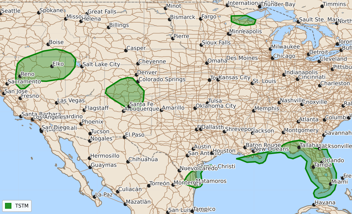
Summary
No organized severe thunderstorms are forecast through tonight. Some isolated thunderstorms may occur over the Great Basin, southern Colorado, northern New Mexico, and the Upper Mississippi Valley.
Product Text
000 ACUS01 KWNS 060049 SWODY1 SPC AC 060047 Day 1 Convective Outlook NWS Storm Prediction Center Norman OK 0747 PM CDT Mon Oct 05 2026 Valid 060100Z - 061200Z ...NO SEVERE THUNDERSTORM AREAS FORECAST... ...SUMMARY... Organized severe thunderstorms are not forecast through tonight. ...Synopsis... A 500 mb upper trough will continue to eject into the Atlantic as surface high pressure sets in from the Great Lakes to the East Coast. Showers and thunderstorms will continue along portions of the Gulf Coast to the FL Peninsula through tonight, where an unstable boundary layer, driven by 70s F surface dewpoints, remains in place. A few lightning flashes may also occur over the next couple of hours with ongoing isolated thunderstorms over the Great Basin, southern CO/northern NM, and the Upper MS Valley given cooler temperatures aloft. ..Squitieri.. 10/06/2026 $$