Convective Outlook for Oct 07, 2026
Issued as Day 1 Convective Outlook at · Valid:
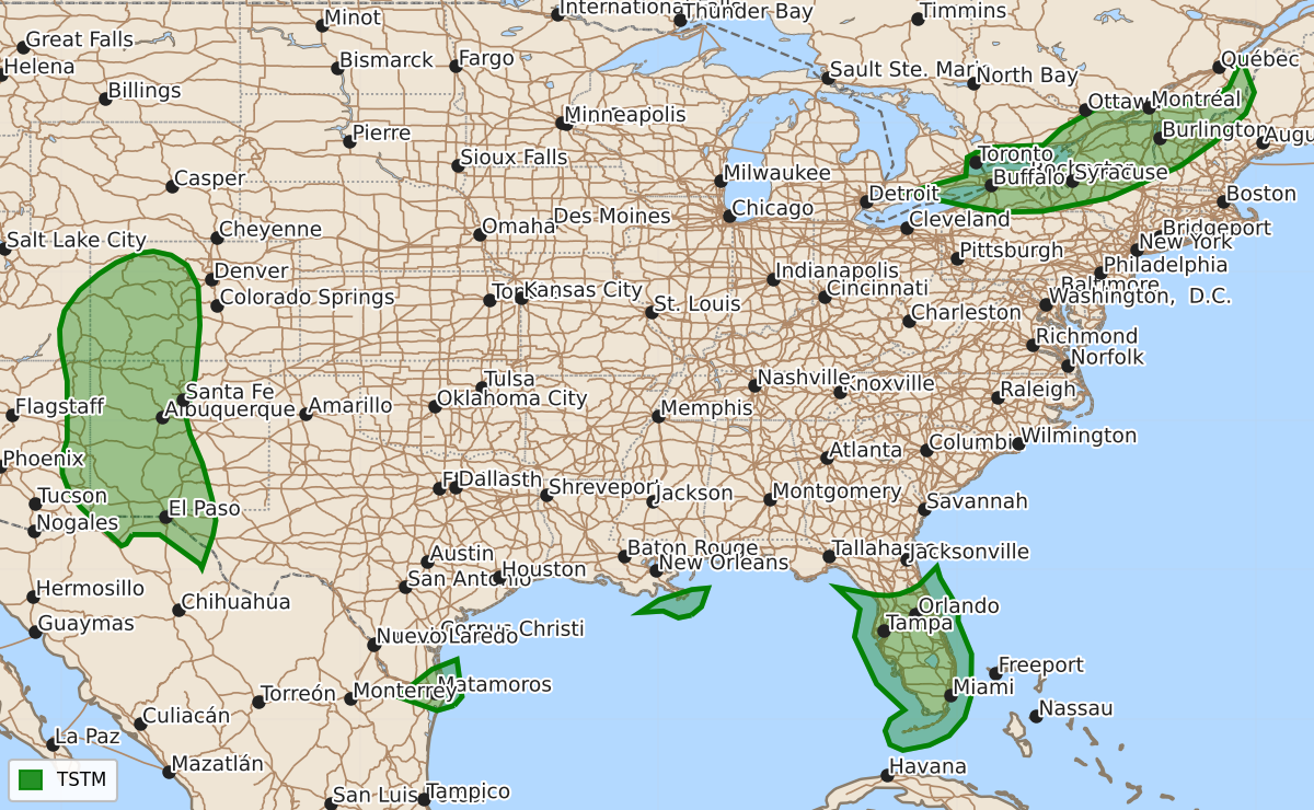
Summary
Isolated thunderstorms may occur this evening and tonight across the Florida Peninsula, the Northeast, and parts of the Four Corners region. No severe thunderstorms are expected across the continental United States through Thursday morning.
Product Text
000 ACUS01 KWNS 080100 SWODY1 SPC AC 080058 Day 1 Convective Outlook NWS Storm Prediction Center Norman OK 0758 PM CDT Wed Oct 07 2026 Valid 080100Z - 081200Z ...NO SEVERE THUNDERSTORM AREAS FORECAST... ...SUMMARY... No severe threat is forecast across the U.S. this evening and tonight. ...DISCUSSION... A mid-level cyclonic flow pattern is in place over the northeastern third of the nation, with west-northwesterly flow located over the remainder of the U.S. At the surface, a moist airmass is located in along the Gulf Coast, where isolated thunderstorms will be possible this evening and tonight, mainly across the Florida Peninsula. Scattered storms will also be possible ahead of a shortwave trough in the Northeast, and across parts of the Four Corners region. No severe threat is expected across the continental U.S. through daybreak on Thursday. ..Broyles.. 10/08/2026 $$