Convective Outlook for Oct 09, 2026
Issued as Day 1 Convective Outlook at · Valid:
Summary
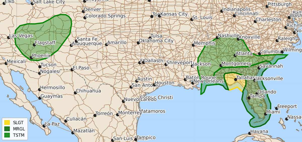
Severe thunderstorms with a tornado threat are expected tonight moving through the Florida Panhandle into southeast Alabama and southwest Georgia.
Product Text
000 ACUS01 KWNS 100100 SWODY1 SPC AC 100058 Day 1 Convective Outlook NWS Storm Prediction Center Norman OK 0758 PM CDT Fri Oct 09 2026 Valid 100100Z - 101200Z ...THERE IS A SLIGHT RISK OF SEVERE THUNDERSTORMS FROM PARTS OF THE FLORIDA PANHANDLE INTO SOUTHEAST ALABAMA AND SOUTHWEST GEORGIA... ...SUMMARY... Thunderstorms associated with Hurricane Isaias will move inland this evening into the overnight. Rotating cells could be associated with a tornado threat, mainly from the Florida Panhandle northward into southeast Alabama and southwest Georgia. ...DISCUSSION... The center of Hurricane Isaias is currently near the Florida coast. The primary band of rainfall is north of the Isaias' center over the western Florida Panhandle. A second rainband extends from the eastern Florida Panhandle southward along the coast of the northwestern Florida Peninsula. Thunderstorms will continue to form within these rainbands and move northward over land this evening. The latest WSR-88D VWPs in the Florida Panhandle have strong low-level shear profiles with large looped hodographs. This will support the development of rotating storms with tornado potential, mainly with cells that remain semi-discrete. The tornado threat is expected to continue through this evening into overnight period, with the threat gradually moving northward into southeast Alabama and southwestern Georgia. ..Broyles.. 10/10/2026 $$