Convective Outlook for Oct 18, 2026
Issued as Day 1 Convective Outlook at · Valid:
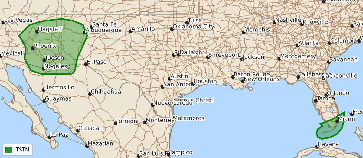
Summary
No severe thunderstorms are forecast through tonight. Isolated showers and thunderstorms may occur across parts of the Southwest.
Product Text
000 ACUS01 KWNS 181942 SWODY1 SPC AC 181940 Day 1 Convective Outlook NWS Storm Prediction Center Norman OK 0240 PM CDT Sun Oct 18 2026 Valid 182000Z - 191200Z ...NO SEVERE THUNDERSTORM AREAS FORECAST... ...SUMMARY... Severe thunderstorms are not forecast through tonight. ...20z Updates... No changes are necessary for the Day 1 update. See previous discussion below. ..Leitman.. 10/18/2026 .PREV DISCUSSION... /ISSUED 1114 AM CDT Sun Oct 18 2026/ ...Synopsis... Tranquil conditions will exist across much of the contiguous United States through tonight. Extensive surface high pressure influencing much of the central and eastern U.S. will favor offshore flow into the northern Gulf of America and feature a seasonably dry/stable airmass. A few weak thunderstorms are possible over south FL and the Keys to the north of a surface front undergoing frontolysis across the southern Gulf and FL Straits. Farther west, an upper trough migrating northeast across the Four Corners will be associated with isolated showers/thunderstorms across parts of the Southwest. $$