Convective Outlook for Oct 20, 2026
Issued as Day 1 Convective Outlook at · Valid:
Summary
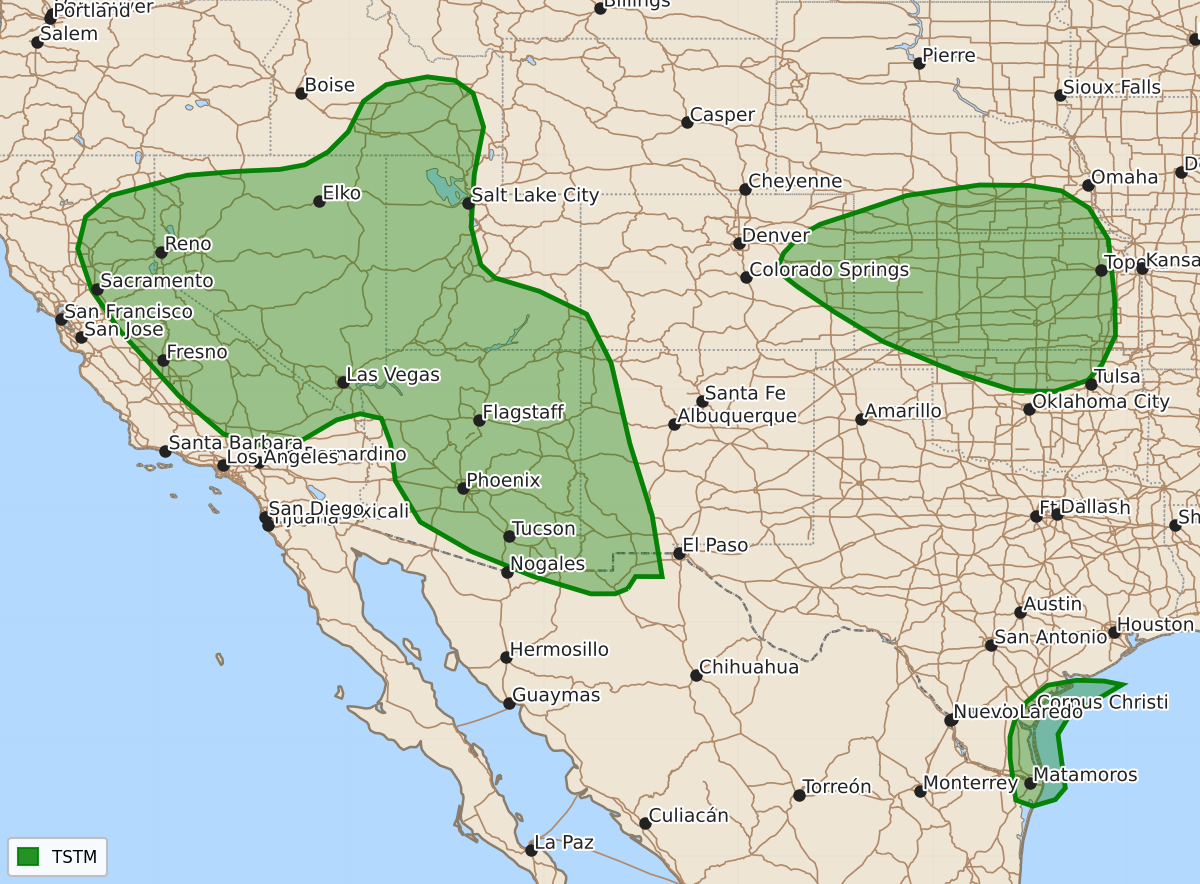
Thunderstorms are possible tonight across parts of the Desert Southwest, the Intermountain West, and along the southern and central Great Plains. No severe weather is expected in the continental United States through Wednesday morning.
Product Text
000 ACUS01 KWNS 210053 SWODY1 SPC AC 210051 Day 1 Convective Outlook NWS Storm Prediction Center Norman OK 0751 PM CDT Tue Oct 20 2026 Valid 210100Z - 211200Z ...NO SEVERE THUNDERSTORM AREAS FORECAST... ...SUMMARY... A severe threat is not forecast across the U.S. through tonight. ...DISCUSSION... An upper-level low will move toward the coast of California this evening as south-southwesterly flow aloft remains in place over the Desert Southwest. Ahead of this system, instability will be sufficient for thunderstorm development this evening into tonight across parts of the Desert Southwest and Intermountain West. Thunderstorms will also be possible tonight along and near an axis of low-level moisture over the southern and central Great Plains. No severe threat is forecast across the continental U.S. through daybreak Wednesday. ..Broyles.. 10/21/2026 $$