Convective Outlook for Oct 24, 2026
Issued as Day 1 Convective Outlook at · Valid:
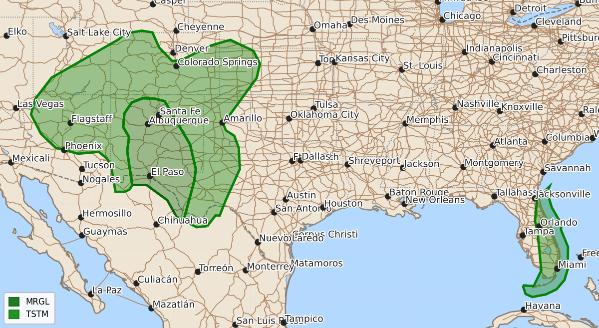
Summary
Isolated large hail, severe wind gusts, and a possible tornado may occur across portions of central and southern New Mexico and far west Texas this evening.
Product Text
000 ACUS01 KWNS 250109 SWODY1 SPC AC 250107 Day 1 Convective Outlook CORR 1 NWS Storm Prediction Center Norman OK 0807 PM CDT Sat Oct 24 2026 Valid 250100Z - 251200Z ...THERE IS A MARGINAL RISK OF SEVERE THUNDERSTORMS ACROSS PORTIONS OF CENTRAL AND SOUTHERN NEW MEXICO AND FAR WEST TEXAS... CORRECTED FOR INCORRECT HEADLINE ...SUMMARY... Isolated severe wind/hail and a tornado remain possible across portions of New Mexico and Far West Texas this evening. ... 01Z Update ... Showers and thunderstorms continue across portions of the Southwest this evening. The most intense of these storms are located across portions of Far West Texas north into central New Mexico, where radar imagery continues to suggest large hail and severe gusts remains possible. This evening's 00 UTC sounding from Albuquerque, NM, shows steep low-level lapse rates that weaken in the mid-levels, yielding MUCAPE around 900 J/kg. This instability has likely peaked for the evening and should weaken with time as the low-levels stabilize with the loss of diurnal heating. The ongoing congealing of thunderstorms will continue, which when combined with weakening instability will lead to an increasingly sporadic and less organized severe threat overnight. That said, sufficient instability and low-level shear exists that the threat for isolated large hail and severe thunderstorm wind gusts may still occur over the next couple of hours. ..Marsh.. 10/25/2026 $$