Mesoscale Discussion 2346
Issued as Mesoscale Discussion 2346 at · Valid:
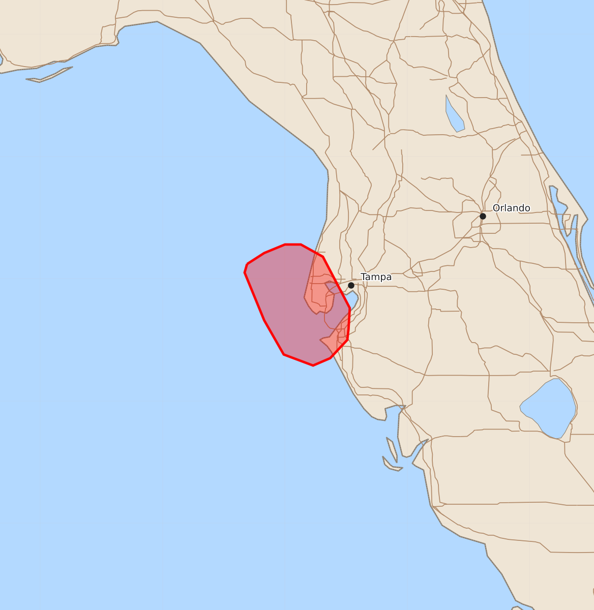
Summary
A brief risk of tornadoes or waterspouts is expected along the west-central Florida coast through the next two hours. These hazards will likely be short-lived and concentrated near the immediate shoreline.
Product Text
000 ACUS11 KWNS 061904 SWOMCD SPC MCD 061904 FLZ000-062100- Mesoscale Discussion 2346 NWS Storm Prediction Center Norman OK 0204 PM CDT Tue Oct 06 2026 Areas affected...west-central Florida Peninsula Concerning...Severe potential...Watch unlikely Valid 061904Z - 062100Z Probability of Watch Issuance...5 percent SUMMARY...The risk for a brief tornado/waterspout will increase in the short term across the west-central Florida coast. DISCUSSION...A few transient supercells have been noted over the eastern Gulf offshore from the west-central FL coast. Recently, a more persistent and stronger rotation signature has been noted with a small supercell west of Tampa Bay. This cell is near the differential heating zone/cold front where low-level instability in stronger and low-level SRH is maximized near and north of the boundary. This cell, and others developing offshore may shift closer to shore over the next 1-2 hours. As this occurs, a risk for a brief tornado/waterspout moving onshore will be possible. The risk will rapidly decrease inland from the immediate coast. Given the generally modest environmental parameter space and very small and focused risk area, a watch is not expected. ..Leitman/Smith.. 10/06/2026 ...Please see www.spc.noaa.gov for graphic product... ATTN...WFO...TBW... LAT...LON 28128331 28218317 28288300 28288287 28188269 27768247 27598248 27508249 27358263 27298277 27388301 27668317 28058333 28128331 MOST PROBABLE PEAK TORNADO INTENSITY...UP TO 90 MPH