Mesoscale Discussion 2353
Issued as Mesoscale Discussion 2353 at · Valid:
Summary
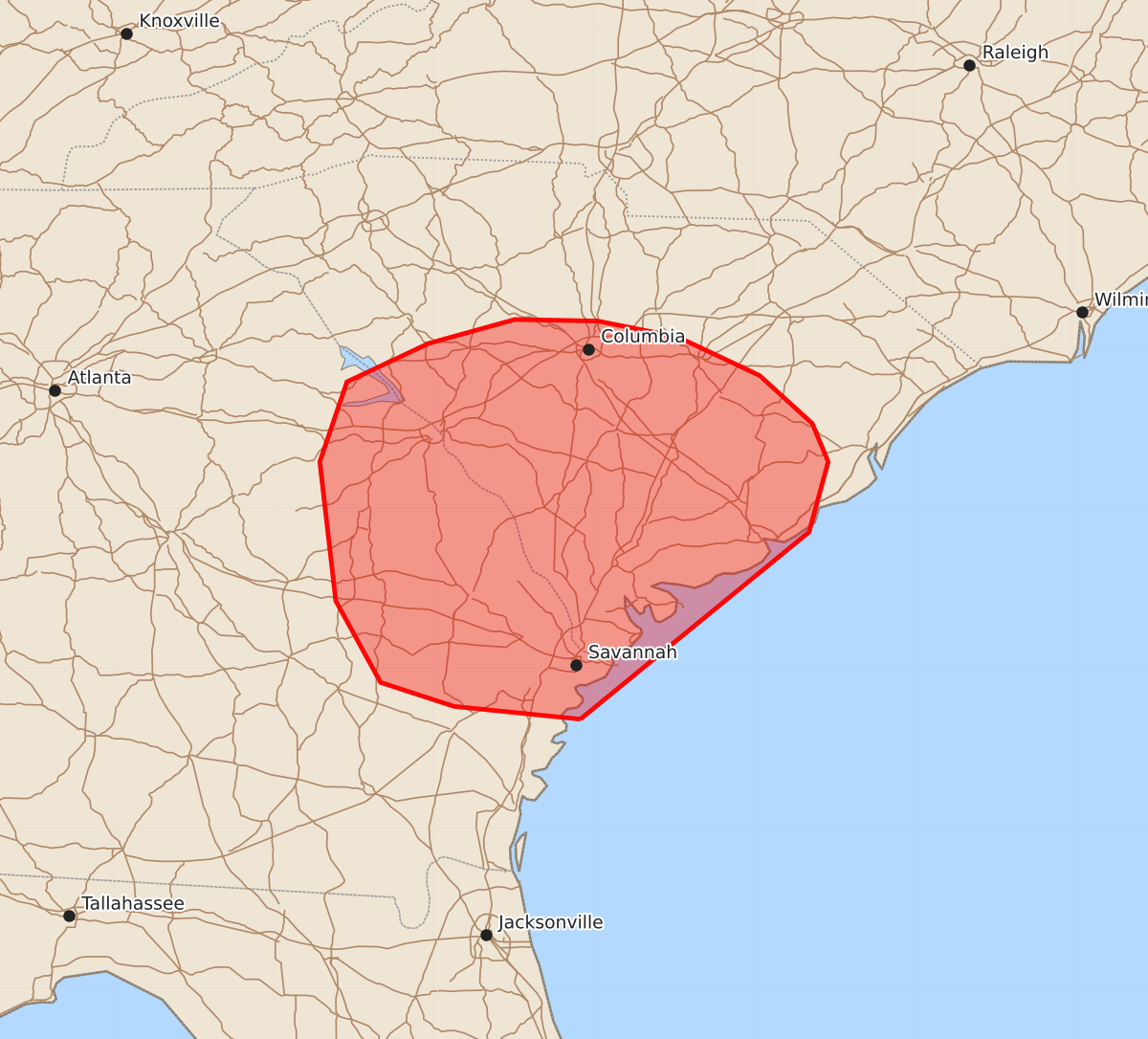
Isolated tornadoes may occur across portions of far eastern Georgia and central and southern South Carolina through the early afternoon.
Product Text
000 ACUS11 KWNS 101701 SWOMCD SPC MCD 101700 SCZ000-GAZ000-101830- Mesoscale Discussion 2353 NWS Storm Prediction Center Norman OK 1200 PM CDT Sat Oct 10 2026 Areas affected...portions of far eastern Georgia into central and southern South Carolina Concerning...Severe potential...Watch possible Valid 101700Z - 101830Z Probability of Watch Issuance...60 percent SUMMARY...The threat for isolated tornadoes continues to gradually increase through the early afternoon. A Tornado Watch issuance may be needed pending strengthening storm trends. DISCUSSION...The warm sector within the right-front quadrant of Isaias' remnants continues to destabilize, with insolation and low-level warm-air advection contributing to low 80s F/mid 70s F surface temperatures/dewpoints becoming more widespread over land, ahead of an approaching confluence band. With time, convective cells both within and preceding this band should deepen and intensify as the boundary layer continues to destabilize. MLCAPE should only reach the 500-1000 J/kg range on a widespread basis, and be constrained to very thin vertical buoyancy profiles. Nonetheless, ample vertical wind shear remains prevalent with Isaias' remnants, with regional VADs still showing enlarged, curved low-level hodographs and over 400 m2/s2 of 0-3 km SRH. Therefore, isolated tornadoes will be possible with the stronger, persistently rotating updrafts that can develop within this marginally unstable but highly sheared airmass. The best chance for a tornado will be with any storms that interact with the northern extent of the more unstable airmass, which is serving as an effective warm front. If an appreciable uptick in updraft strength becomes evident, then a Tornado Watch issuance may be needed. ..Squitieri/Smith.. 10/10/2026 ...Please see www.spc.noaa.gov for graphic product... ATTN...WFO...ILM...CHS...CAE...GSP...JAX...FFC... LAT...LON 31688108 31768187 31918233 32428261 33298271 33798254 34038203 34188149 34178097 34078047 33837996 33537963 33297953 32857965 31688108 MOST PROBABLE PEAK TORNADO INTENSITY...85-110 MPH MOST PROBABLE PEAK WIND GUST...UP TO 60 MPH