Mesoscale Discussion 2365
Issued as Mesoscale Discussion 2365 at · Valid:
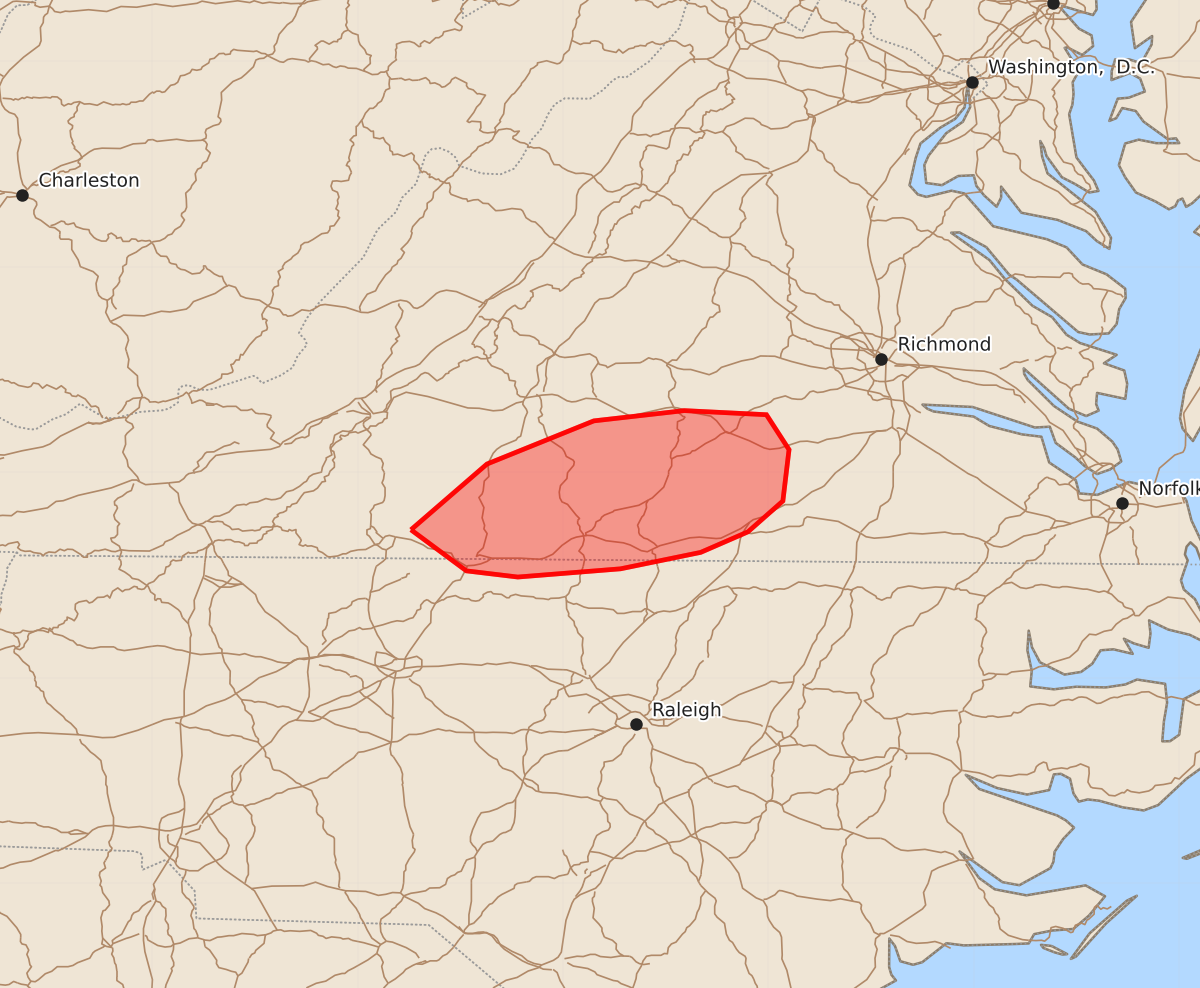
Summary
Portions of southern Virginia may experience a brief tornado within the next two hours.
Product Text
000 ACUS11 KWNS 112016 SWOMCD SPC MCD 112015 VAZ000-NCZ000-112115- Mesoscale Discussion 2365 NWS Storm Prediction Center Norman OK 0315 PM CDT Sun Oct 11 2026 Areas affected...portions of southern Virginia Concerning...Severe potential...Watch unlikely Valid 112015Z - 112115Z Probability of Watch Issuance...5 percent SUMMARY...A brief tornado cannot be ruled out with storms along an effective frontal band over the next couple of hours. DISCUSSION...A frontal band, characterized by veered surface winds and a 5-10 F dewpoint decrease, continued to advance eastward with the surface low, and is preceded by a wedge of 75-80 F surface temperatures with low 70s F dewpoints. Convection has attempted to become established along this boundary, but storms have not become overly robust. This is likely to remain the case given localized subsidence. However, given elongated hodographs with some low-level curvature (e.g. the latest FCX VAD and 20Z mesoanalysis), any storm that manages to mature may acquire brief rotation. In a few hours, this frontal band will outpace the narrow warm sector, with the sparse/localized severe threat expected to diminish thereafter. ..Squitieri/Smith.. 10/11/2026 ...Please see www.spc.noaa.gov for graphic product... ATTN...WFO...AKQ...RAH...RNK... LAT...LON 36727974 37047937 37257885 37307841 37287801 37117790 36867793 36717810 36617833 36537872 36497922 36527947 36727974 MOST PROBABLE PEAK TORNADO INTENSITY...UP TO 90 MPH MOST PROBABLE PEAK WIND GUST...UP TO 60 MPH