Mesoscale Discussion 2366
Issued as Mesoscale Discussion 2366 at · Valid:
Summary
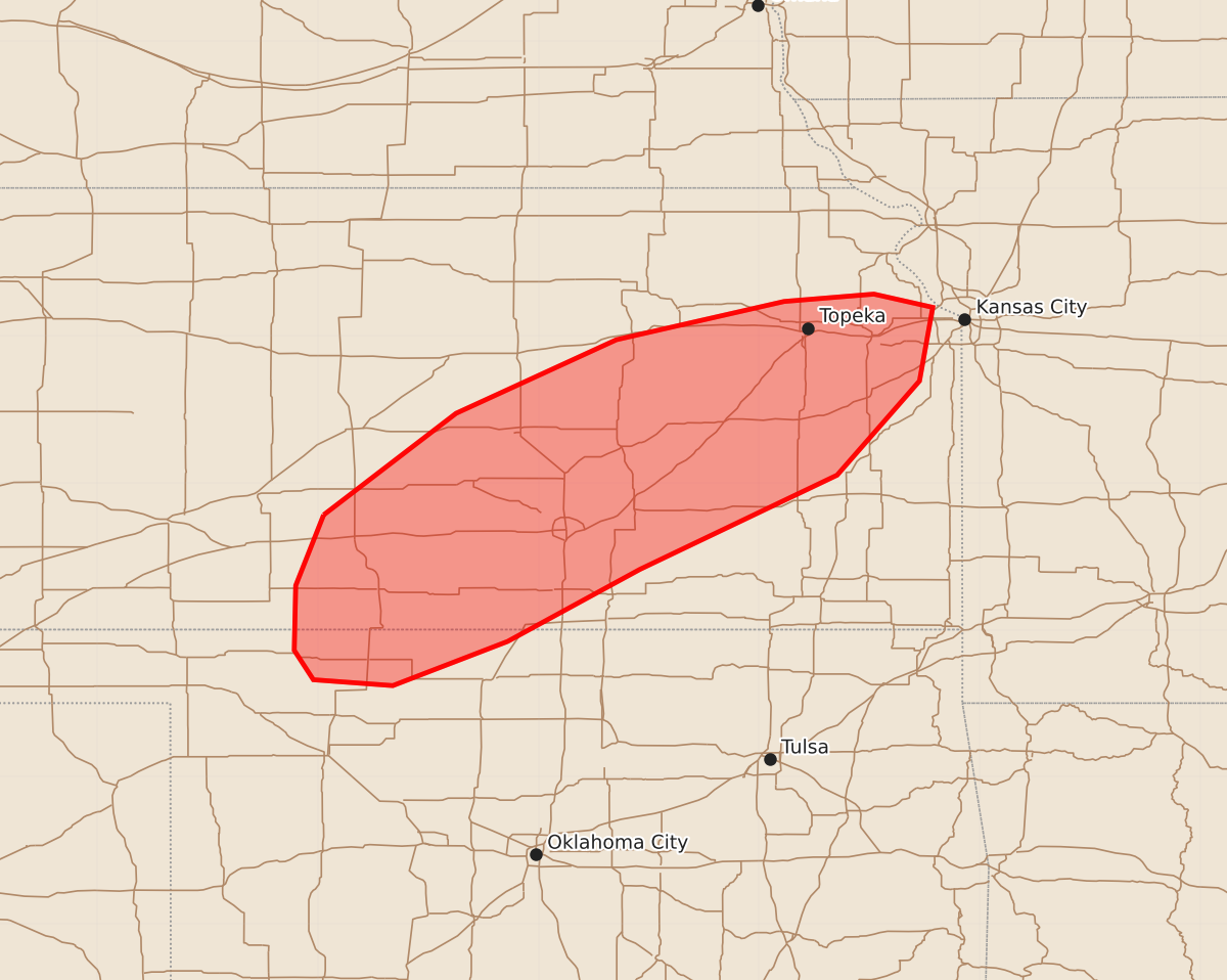
Severe thunderstorms capable of producing damaging wind gusts and large hail may develop through the afternoon across portions of far northwestern Oklahoma and southern and eastern Kansas. These storms could potentially produce tornadoes in addition to winds exceeding 75 mph and hail over 2 inches in diameter.
Product Text
000 ACUS11 KWNS 132008 SWOMCD SPC MCD 132007 KSZ000-OKZ000-132200- Mesoscale Discussion 2366 NWS Storm Prediction Center Norman OK 0307 PM CDT Tue Oct 13 2026 Areas affected...portions of far northwestern Oklahoma into southern and eastern Kansas Concerning...Severe potential...Watch likely Valid 132007Z - 132200Z Probability of Watch Issuance...80 percent SUMMARY...The threat for severe wind and hail will increase as storms continue to become more numerous through the afternoon. A risk for 75+ mph gusts and 2+ inch diameter hail will develop, and a tornado or two also cannot be ruled out. A Severe Thunderstorm Watch will likely be needed in the next hour or two to address the impending severe threat. DISCUSSION...A surface cold front continues to sag southward across the central and southern Plains, with anafrontal convection noted across portions of central KS. Though anafrontal, KDDC radar data shows an increasingly eastward progression of the ongoing storms, which may ultimately lead to storms outpacing the cold front. Once this occurs, these storms will encounter a well-mixed boundary layer, where surface observations show 90 F surface temperatures amid 70+ F dewpoints, yielding over 2000 J/kg MLCAPE (per 19Z mesoanalysis). Furthermore, around 50 kts of effective bulk (speed) shear coincides with this buoyancy, suggesting multicells and supercells are likely. 12 and 18Z regional observed soundings depicted 7.5 C/km lapse rates, suggesting that any updrafts preceding the cold front could become strong and well organized. Severe wind and hail are the main concerns, with some gusts potentially exceeding 75 mph, along with 2+ inch diameter hail. Furthermore, any updrafts that can sustain supercellular characteristics ahead of the surface cold front, and become dominant (e.g. relatively unperturbed inflow) may produce a tornado, though confidence in this scenario is low. Given the expected coverage of severe storms ahead of the cold front in the next few hours, a Severe Thunderstorm Watch issuance is likely. ..Squitieri/Smith.. 10/13/2026 ...Please see www.spc.noaa.gov for graphic product... ATTN...WFO...EAX...TOP...ICT...OUN...DDC... LAT...LON 37789896 38479806 38979697 39239583 39289522 39199482 38699491 38059547 37419681 36929771 36629849 36669903 36869916 37309915 37789896 MOST PROBABLE PEAK TORNADO INTENSITY...85-110 MPH MOST PROBABLE PEAK WIND GUST...65-80 MPH MOST PROBABLE PEAK HAIL SIZE...1.50-2.50 IN