Mesoscale Discussion 2367
Issued as Mesoscale Discussion 2367 at · Valid:
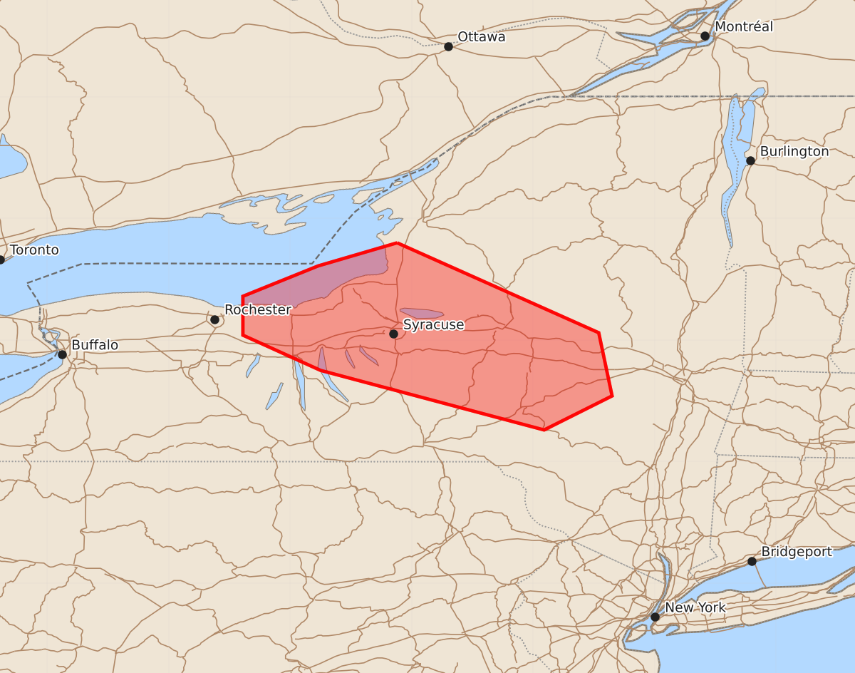
Summary
Scattered thunderstorms may develop across central New York this afternoon, with a few storms potentially producing damaging wind gusts.
Product Text
000 ACUS11 KWNS 132009 SWOMCD SPC MCD 132008 NYZ000-132215- Mesoscale Discussion 2367 NWS Storm Prediction Center Norman OK 0308 PM CDT Tue Oct 13 2026 Areas affected...Central New York Concerning...Severe potential...Watch unlikely Valid 132008Z - 132215Z Probability of Watch Issuance...20 percent SUMMARY...Scattered thunderstorm development is possible this afternoon. A few storms may produce gusty/damaging winds. A watch is not currently anticipated. DISCUSSION...Latest visible satellite imagery shows a differential heating/baroclinic zone extending from near Oswego to near Albany NY. Persistent clouds have limited temperatures north of this zone to the lower 60s and a stable boundary-layer. To the south, temperatures have warmed into the mid 70s, yielding SBCAPE values around 1000 J/kg. Agitated cumulus are developing near the lake shore and are expected track down the boundary and grow into showers and thunderstorms during the next couple of hours. Winds aloft are quite strong with 50+ knots at 500mb and considerable veering profiles near the surface. While a few strong storms are expected, warm temperatures around 700mb and the onset of diurnal cooling should limit the overall risk of severe storms through the early evening. ..Hart/Smith.. 10/13/2026 ...Please see www.spc.noaa.gov for graphic product... ATTN...WFO...ALY...BGM...BUF... LAT...LON 43807612 43067446 42547435 42267491 42757675 43047739 43367739 43617677 43807612 MOST PROBABLE PEAK TORNADO INTENSITY...UP TO 90 MPH MOST PROBABLE PEAK WIND GUST...UP TO 60 MPH