Mesoscale Discussion 2368
Issued as Mesoscale Discussion 2368 at · Valid:
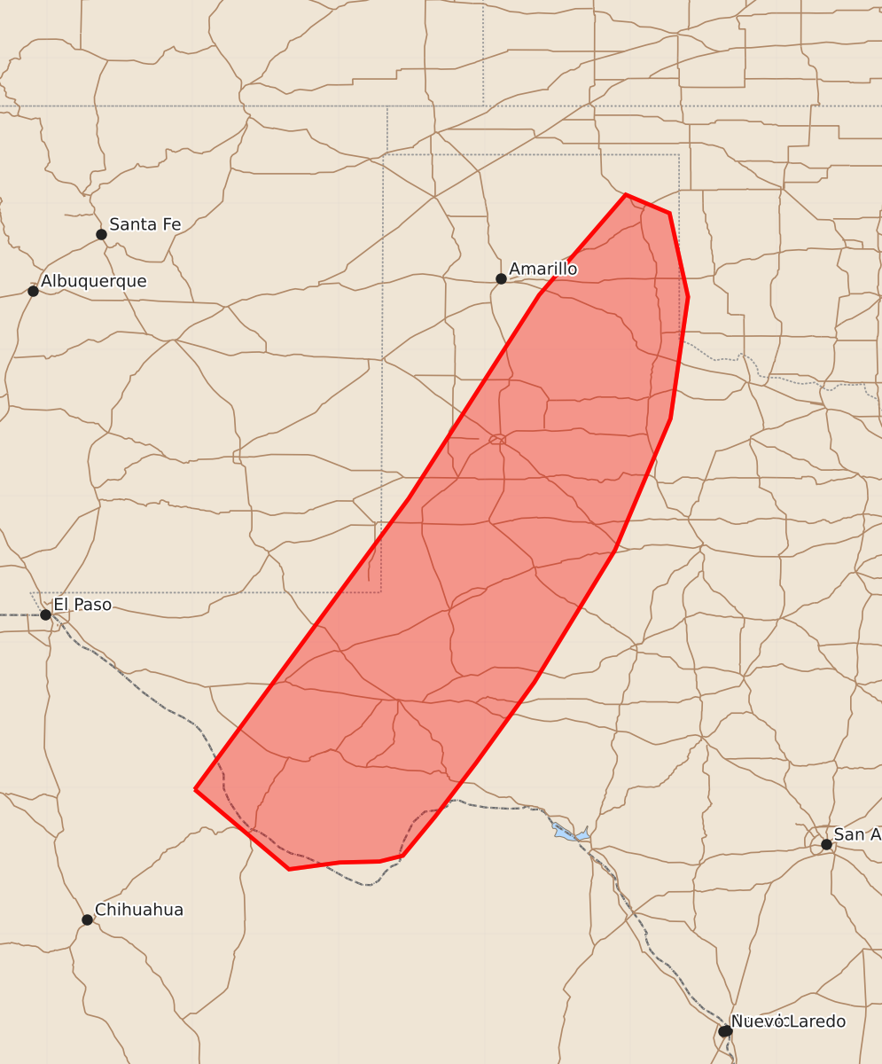
Summary
Severe thunderstorms capable of producing damaging wind gusts and large hail may develop across the eastern Texas Panhandle and southwestern Texas through the evening. High-intensity threats include wind gusts exceeding 75 mph and hail larger than two inches, particularly in the northern parts of the affected area.
Product Text
000 ACUS11 KWNS 132103 SWOMCD SPC MCD 132102 OKZ000-TXZ000-NMZ000-132230- Mesoscale Discussion 2368 NWS Storm Prediction Center Norman OK 0402 PM CDT Tue Oct 13 2026 Areas affected...portions of the eastern Texas Panhandle to far southwestern Texas Concerning...Severe potential...Watch possible Valid 132102Z - 132230Z Probability of Watch Issuance...60 percent SUMMARY...The threat for severe wind and hail will increase into the evening hours as storms increase in number and intensity. A few instances of 75+ mph gusts or 2+ inch hail are possible, especially for storms farther north into the TX Panhandle. A WW issuance is possible, especially farther north once details regarding locations of greater storm coverage become apparent. DISCUSSION...Thunderstorm initiation is taking place across western TX, both along and behind a dryline. Ahead of the dryline, upper 60s F surface dewpoints and 7+ C/km mid-level lapse rates are contributing to 1500-2500 J/kg MLCAPE. Furthermore, 35-50 kts of effective bulk shear are coinciding with this buoyancy, with the stronger shear noted over the TX Panhandle, in closer proximity to the stronger 500 mb southwesterly flow. The current thinking is that storms will increase in number and severity across western TX, with several multicells and transient supercells likely. Severe wind and hail will be the main threats. The best chance for 75+ mph gusts and 2+ inch diameter hail will exist over the eastern TX Panhandle, given stronger 500 mb flow overspreading better buoyancy (e.g. 2500 J/kg MLCAPE). A Severe Thunderstorm Watch issuance may eventually be needed, especially where the greater concentration of storms occur (i.e. eastern TX Panhandle into northwestern TX). ..Squitieri/Smith.. 10/13/2026 ...Please see www.spc.noaa.gov for graphic product... ATTN...WFO...OUN...SJT...LUB...AMA...MAF... LAT...LON 29980498 32970278 35060144 36090055 35900010 35049991 33790009 32440066 31080149 30250209 29700251 29300284 29240308 29230349 29160401 29980498 MOST PROBABLE PEAK TORNADO INTENSITY...UP TO 90 MPH MOST PROBABLE PEAK WIND GUST...65-80 MPH MOST PROBABLE PEAK HAIL SIZE...1.50-2.50 IN