Mesoscale Discussion 2375
Issued as Mesoscale Discussion 2375 at · Valid:
Summary
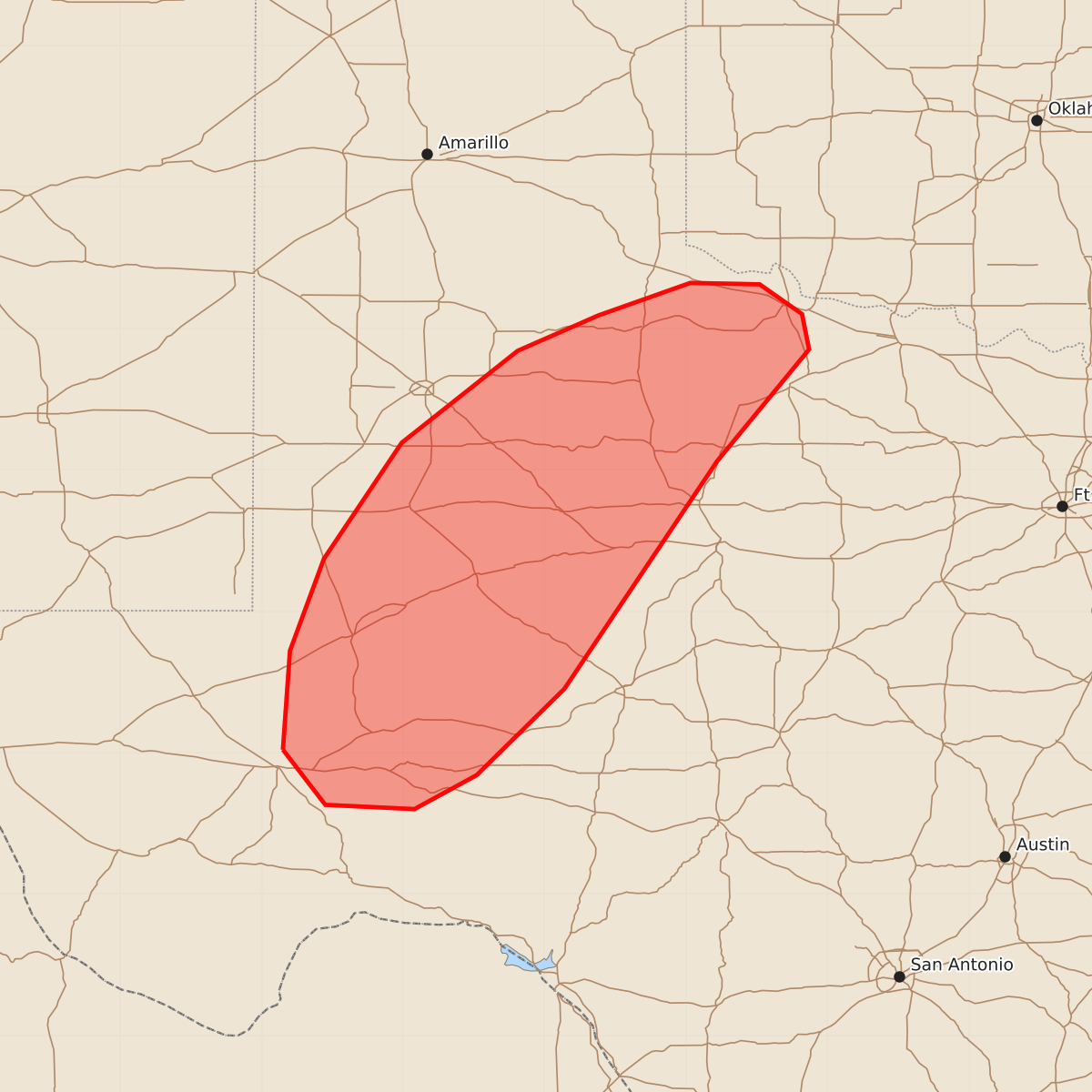
Severe storms capable of producing damaging wind gusts and hail are expected to move northeastward across parts of the Permian Basin and South Plains through the early evening.
Product Text
000 ACUS11 KWNS 141958 SWOMCD SPC MCD 141958 TXZ000-142200- Mesoscale Discussion 2375 NWS Storm Prediction Center Norman OK 0258 PM CDT Wed Oct 14 2026 Areas affected...parts of the Permian Basin to South Plains Concerning...Severe potential...Watch likely Valid 141958Z - 142200Z Probability of Watch Issuance...80 percent SUMMARY...Storms will likely persist into the early evening, spreading northeastward and producing areas of severe gusts and hail. DISCUSSION...A north-south line of storms has erupted southwest of the Midland TX area, in a zone of strong heating and substantial low-level moisture. These storms will likely persist for several hours as they travel northeastward across the destabilizing air mass. Further convection is noted northward toward Lubbock, and also extending east from there along the old outflow boundary. Both cells and bowing structures are expected with deep-layer effective shear over 40 kt. Low-level shear is not particularly strong, but does increase with northward extent. The LBB VWP shows 0-1 SRH around 75 m2/s2. Initial vigorous updrafts may support a brief/weak tornado, with most of the severe mode being wind and hail. ..Jewell/Guyer.. 10/14/2026 ...Please see www.spc.noaa.gov for graphic product... ATTN...WFO...OUN...SJT...LUB...MAF... LAT...LON 31020285 31720280 32370256 33190201 33840119 34090062 34329997 34319948 34109918 33859913 33069978 31450086 30840148 30600192 30630255 31020285 MOST PROBABLE PEAK TORNADO INTENSITY...UP TO 90 MPH MOST PROBABLE PEAK WIND GUST...65-80 MPH MOST PROBABLE PEAK HAIL SIZE...1.00-1.75 IN