Mesoscale Discussion 2378
Issued as Mesoscale Discussion 2378 at · Valid:
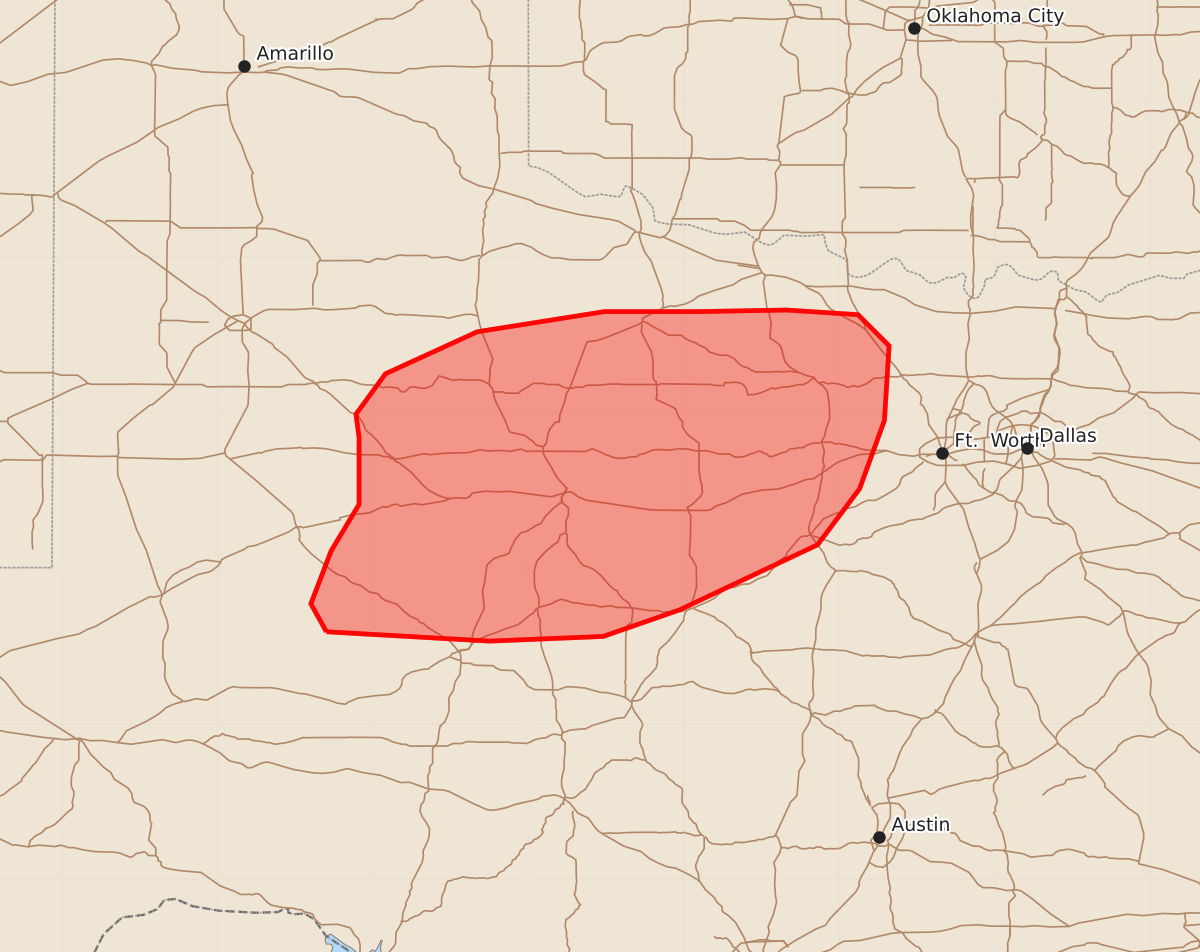
Summary
Scattered thunderstorms may develop across portions of northwest Texas this afternoon, bringing the potential for isolated wind gusts up to 60 mph and small hail.
Product Text
000 ACUS11 KWNS 151913 SWOMCD SPC MCD 151913 TXZ000-152145- Mesoscale Discussion 2378 NWS Storm Prediction Center Norman OK 0213 PM CDT Thu Oct 15 2026 Areas affected...portions of the greater northwest Texas region Concerning...Severe potential...Watch unlikely Valid 151913Z - 152145Z Probability of Watch Issuance...5 percent SUMMARY...Scattered thunderstorms will continue to develop in an increasingly unstable airmass this afternoon. Although vertical shear will support some thunderstorm organization, weak lapse rates and thunderstorms quickly moving into a cooler airmass to the north will limit the potential for an organized wind threat. A watch is currently not expected. DISCUSSION...A messy surface pattern is found across the southern Plains, with a congealed outflow/stationary front stretching across northwest Texas into southeast Oklahoma and west-central Arkansas. A slowly moving synoptic front is located to the west and north of the stationary front. In between widespread light to moderate precipitation is falling across far northwest Texas and much of western/central Oklahoma. Along and south of the stationary front, temperatures have warmed into the mid to upper-80Fs in the presence of widespread dewpoints in the mid-60Fs to lower-70Fs. The result is MUCAPE values in excess of 3000 J/kg ahead of the cold front across west Texas and south of the stationary front. Here scattered thunderstorms are developing along the surface cold front and also along the remnant stationary front as convective temperatures are reached. Vertical profiles across the area show deep-layer shear on the order of 30-40 knots, oriented from southwest to northeast. They also show moist-adiabatic profiles, with weak mid-level lapse rates. Thus, while thunderstorm organization is possible, including transient mid-level thunderstorm rotation, the large hail threat should be muted. The deep-layer shear vector is also oriented in such a manner that will favor updrafts developing in the warm sector to move across the stationary front and into the cooler surface airmass. Thus, while warm-sector low-level lapse rates on the order of 7-8 C/km exist, thunderstorms will likely spend little time realizing them before moving into an airmass with low-level lapse rates closer to 4-5 C/km. This should limit the potential for organized widespread wind threat, and limit the potential to isolated wet downbursts. Should a thunderstorm develop a sufficiently strong cold pool that can stay ahead of the synoptic front and outflow boundary, a small window for damaging winds will exist this afternoon/evening. This scenario is far from certain, but will be monitored. ..Marsh/Guyer.. 10/15/2026 ...Please see www.spc.noaa.gov for graphic product... ATTN...WFO...FWD...OUN...SJT...LUB...MAF... LAT...LON 31590130 31770140 32110127 32410109 32840109 32990111 33250092 33520033 33659951 33659891 33669834 33639788 33439768 32959771 32519787 32159814 31739903 31569952 31530025 31590130 MOST PROBABLE PEAK WIND GUST...UP TO 60 MPH MOST PROBABLE PEAK HAIL SIZE...UP TO 1.25 IN