Mesoscale Discussion 2383
Issued as Mesoscale Discussion 2383 at · Valid:
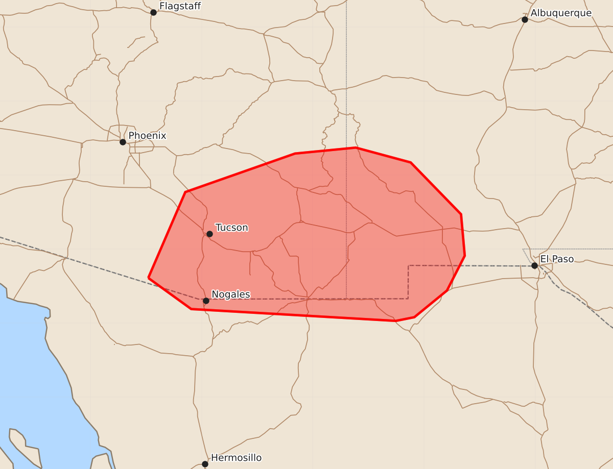
Summary
Isolated severe thunderstorms capable of producing hail and gusty winds are expected to develop across southeastern Arizona and southwest New Mexico this afternoon and into the evening.
Product Text
000 ACUS11 KWNS 192001 SWOMCD SPC MCD 192000 NMZ000-AZZ000-192200- Mesoscale Discussion 2383 NWS Storm Prediction Center Norman OK 0300 PM CDT Mon Oct 19 2026 Areas affected...portions of southeastern Arizona and southwest New Mexico Concerning...Severe potential...Watch unlikely Valid 192000Z - 192200Z Probability of Watch Issuance...20 percent SUMMARY...Thunderstorm cover is expected to increase later this afternoon with an isolated risk for hail or severe gusts. A WW is unlikely. DISCUSSION...As of 2000 UTC, visible imagery showed cumulus towers and initial thunderstorms deepening near the international border and across the higher terrain of southeastern AZ. Surface temperatures have steadily warmed this afternoon ahead of a weak upper trough. Surface dewpoints in the upper 50s with mid-level temperatures near -12 to -14 C are supporting around 500 J/kg of MLCAPE. Continue heating with steepening of lapse rate profiles should remove inhibition with additional thunderstorms expected to develop in and near the higher terrain this afternoon. While buoyancy will likely remain modest, effective shear of 30-40 kt could support some storm organization. Isolated, marginally severe hail and gusty outflow winds may occur with the stronger cells that develop and spread eastward from AZ into NM. Coverage should gradually increase this afternoon and into the evening hours as the upper trough moves overhead. Hi-res guidance shows this well, but with only sporadic more intense storms given the marginal buoyancy. This should keep the severe risk fairly isolated and a WW is unlikely. ..Lyons/Guyer.. 10/19/2026 ...Please see www.spc.noaa.gov for graphic product... ATTN...WFO...ABQ...EPZ...TWC... LAT...LON 31611172 32771122 33290974 33370892 33170818 32470750 31910745 31440769 31080813 31030838 31191114 31611172 MOST PROBABLE PEAK WIND GUST...UP TO 60 MPH MOST PROBABLE PEAK HAIL SIZE...UP TO 1.25 IN