Mesoscale Discussion 2387
Issued as Mesoscale Discussion 2387 at · Valid:
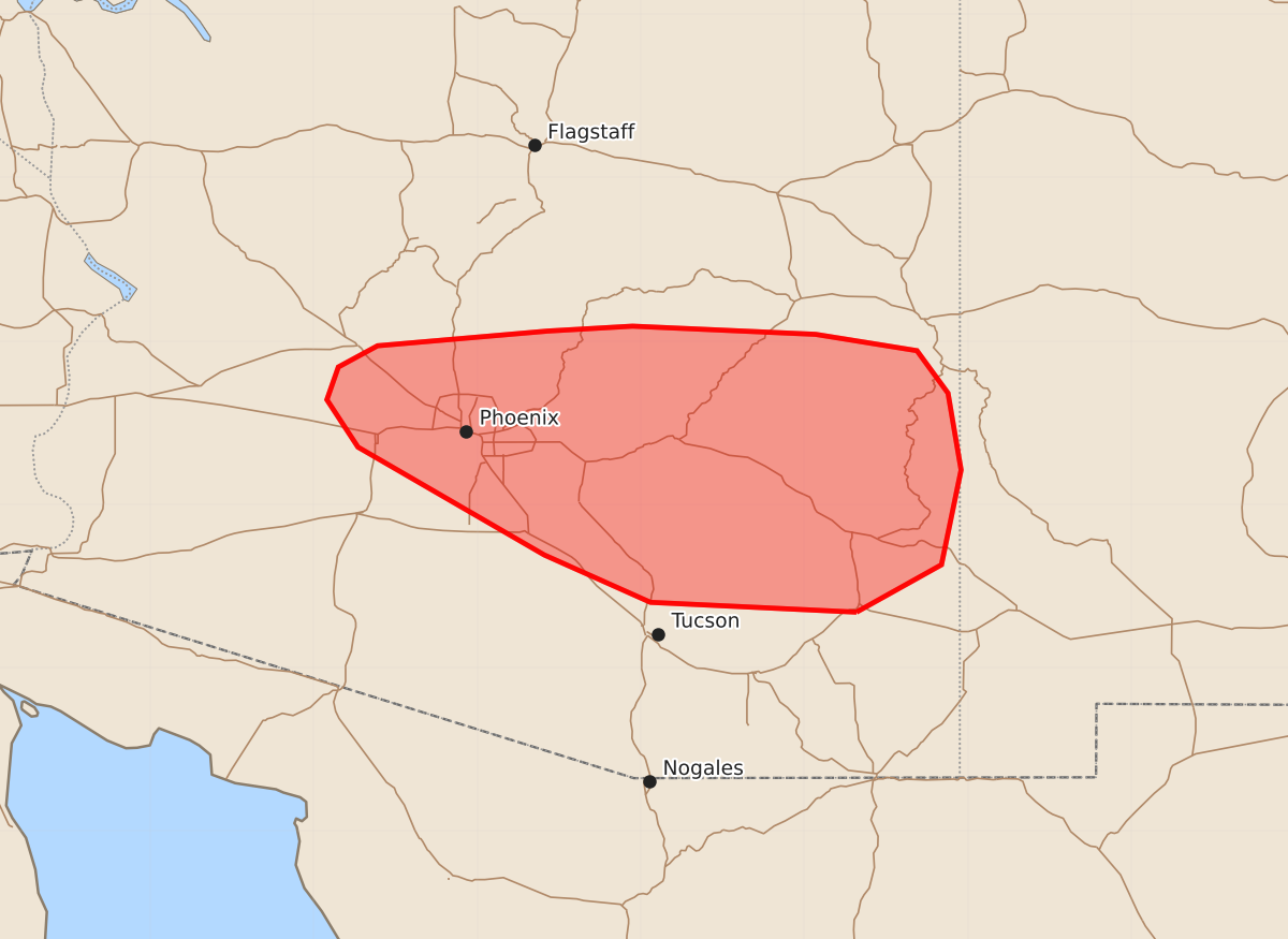
Summary
Parts of southern and central Arizona may experience severe thunderstorms this afternoon, with large hail and severe wind gusts being the primary concerns. Severe weather intensity is expected to increase between 2:00 PM and 4:00 PM CDT.
Product Text
000 ACUS11 KWNS 211836 SWOMCD SPC MCD 211835 AZZ000-212100- Mesoscale Discussion 2387 NWS Storm Prediction Center Norman OK 0135 PM CDT Wed Oct 21 2026 Areas affected...Parts of southern and central Arizona Concerning...Severe potential...Watch possible Valid 211835Z - 212100Z Probability of Watch Issuance...60 percent SUMMARY...The severe risk will increase through the afternoon, especially between 20Z and 23Z. The primary concerns will be large hail and severe wind gusts. A watch may eventually be needed. DISCUSSION...The latest visible satellite imagery shows deepening boundary-layer cumulus evolving across parts of southern AZ -- beneath a plume of mid/high-level clouds. Over the next few hours, continued differential heating and orographic circulations should promote scattered thunderstorm development in the 20Z-23Z time frame. The KEMX VWP is sampling an elongated hodograph (40-50 kt of 0-6 km shear) and modest low-level hodograph curvature (albeit weaker low-level shear compared to areas farther north). This, combined with the destabilizing PBL, will support discrete/semi-discrete supercells and organized clusters. Given the expectation for separated updrafts, large to very large hail and locally severe gusts will be the primary concerns (though a tornado or two cannot be ruled out with any longer-lived supercells). While timing is somewhat uncertain, a watch may eventually be needed for parts of the area. ..Weinman/Mosier.. 10/21/2026 ...Please see www.spc.noaa.gov for graphic product... ATTN...WFO...TWC...FGZ...PSR... LAT...LON 32340968 32401094 32691159 33351273 33641292 33841285 33971261 34061157 34091105 34040993 33940931 33680912 33210904 32630916 32340968 MOST PROBABLE PEAK TORNADO INTENSITY...85-110 MPH MOST PROBABLE PEAK WIND GUST...55-70 MPH MOST PROBABLE PEAK HAIL SIZE...1.50-2.50 IN