Mesoscale Discussion 2398
Issued as Mesoscale Discussion 2398 at · Valid:
Summary
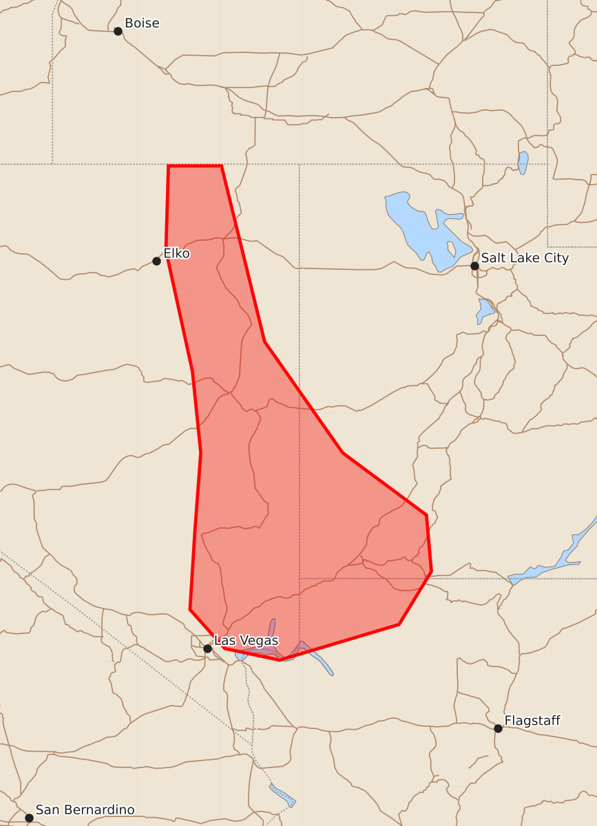
Strong gusts, large hail, and an isolated tornado are possible this afternoon across eastern Nevada, southwest Utah, and extreme northwest Arizona. The threat is expected to be sparse and relatively low in severity across the affected area.
Product Text
000 ACUS11 KWNS 221747 SWOMCD SPC MCD 221747 UTZ000-AZZ000-NVZ000-221915- Mesoscale Discussion 2398 NWS Storm Prediction Center Norman OK 1247 PM CDT Thu Oct 22 2026 Areas affected...Eastern Nevada...southwest Utah and extreme northwest Arizona Concerning...Severe potential...Watch unlikely Valid 221747Z - 221915Z Probability of Watch Issuance...20 percent SUMMARY...Occasional strong-severe gusts, isolated large hail and an isolated tornado will all be possible. However, the threat is expected to remain relatively sparse and on the lower margins for a broad area, so a watch is not currently anticipated. DISCUSSION...A midlevel trough over southern/central CA is beginning to eject east-northeastward toward the southern Great Basin, with downstream forcing for ascent likewise overspreading eastern NV, western UT and extreme northwest AZ. Surface heating in cloud breaks is contributing to destabilization and storm coverage is expected to increase in broken bands through the afternoon. Long, straight hodographs will favor a mix of splitting cells and line segments capable of producing isolated large hail and strong-severe gusts. The magnitude of the threat will be limited somewhat by relatively shallow buoyancy profiles. The environment is a bit more favorable for supercells across southwest UT and vicinity where buoyancy is larger with mid-upper 50s dewpoints and the storm mode will be semi-discrete. ..Thompson/Guyer.. 10/22/2026 ...Please see www.spc.noaa.gov for graphic product... ATTN...WFO...FGZ...SLC...VEF...LKN... LAT...LON 38521352 37771251 37091245 36451284 36021428 36161494 36631536 37591530 38521523 39501533 40961565 41981562 41981498 39861446 38521352 MOST PROBABLE PEAK TORNADO INTENSITY...UP TO 90 MPH MOST PROBABLE PEAK WIND GUST...55-70 MPH MOST PROBABLE PEAK HAIL SIZE...1.00-1.75 IN