Mesoscale Discussion 2407
Issued as Mesoscale Discussion 2407 at · Valid:
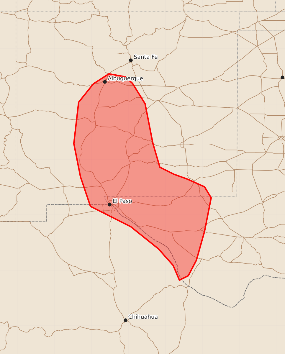
Summary
Severe thunderstorms capable of producing damaging winds and large hail are expected to move through central and southern New Mexico into far West Texas late this afternoon and into the early evening. Potential hazards include significant straight-line winds and hail, with a slight possibility of occasional tornadoes.
Product Text
000 ACUS11 KWNS 242011 SWOMCD SPC MCD 242010 TXZ000-NMZ000-242215- Mesoscale Discussion 2407 NWS Storm Prediction Center Norman OK 0310 PM CDT Sat Oct 24 2026 Areas affected...Central and Southern New Mexico into far West Texas Concerning...Severe potential...Watch likely Valid 242010Z - 242215Z Probability of Watch Issuance...80 percent SUMMARY...A severe thunderstorm watch will likely be needed by late this afternoon into early evening as convective development occurs and enters into the Slight Risk area. Damaging straight-line winds and hail are the primary threats, though a tornado or two cannot be ruled out. DISCUSSION...As forcing for ascent moves out of northern Mexico and into New Mexico/Texas, convective development is expected to occur and move into the Slight Risk Area. The 18Z EPZ sounding shows modest instability with a strongly-sheared, straight-line hodograph that will support a mix of supercell thunderstorms and upscale-growing line segments. Southeasterly surface flow from south-central/southeast New Mexico into Far West Texas could support slower storm motions and a relatively greater potential for large hail and a tornado or two. However, the primary threat across the watch area will be for damaging straight-line winds and hail. The HRRR-RRFS time-lagged ensemble has upscale-growing line segments entering far West Texas by 23-00Z, while storms further north and east in New Mexico will support both a hail and wind threat. A severe thunderstorm watch will likely be needed by early evening. ..Halbert/Mosier.. 10/24/2026 ...Please see www.spc.noaa.gov for graphic product... ATTN...WFO...MAF...ABQ...EPZ... LAT...LON 31730703 32530730 33430748 34550735 35050695 35320653 35240609 35060589 34510555 33440534 32790515 32600477 32470441 32260394 31960376 31050394 30270416 29850438 29730462 30130479 30580519 31180594 31730703 MOST PROBABLE PEAK TORNADO INTENSITY...UP TO 90 MPH MOST PROBABLE PEAK WIND GUST...65-80 MPH MOST PROBABLE PEAK HAIL SIZE...1.50-2.50 IN