Mesoscale Discussion 2413
Issued as Mesoscale Discussion 2413 at · Valid:
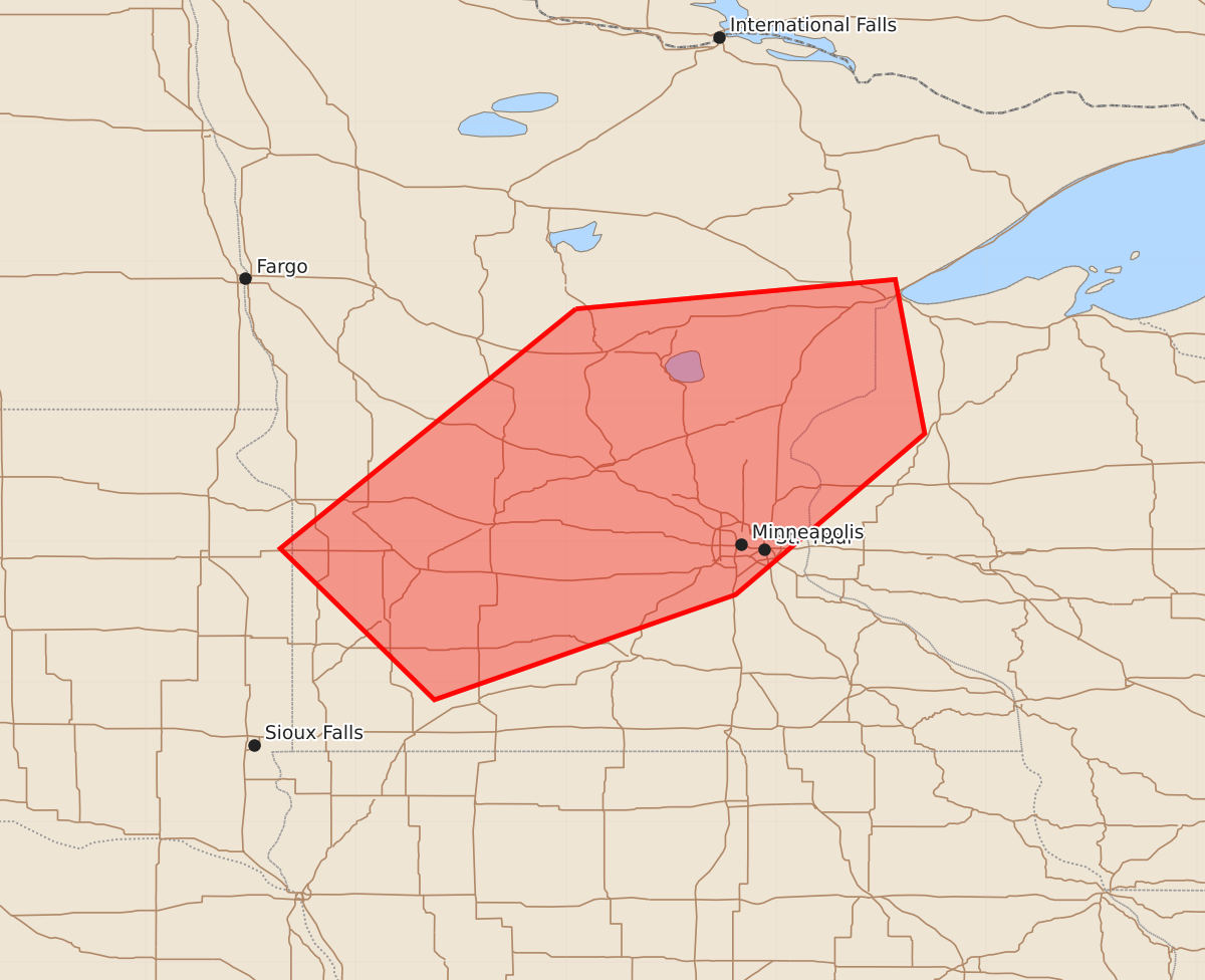
Summary
Increasing thunderstorm development across south central to east central Minnesota and northwestern Wisconsin may produce severe hail this afternoon. There is a potential for tornadoes and damaging wind gusts near and north of the Minneapolis area later this afternoon into the early evening.
Product Text
000 ACUS11 KWNS 281832 SWOMCD SPC MCD 281831 WIZ000-MNZ000-SDZ000-282100- Mesoscale Discussion 2413 NWS Storm Prediction Center Norman OK 0131 PM CDT Wed Oct 28 2026 Areas affected...south central through east central Minnesota into northwestern Wisconsin Concerning...Severe potential...Watch possible Valid 281831Z - 282100Z Probability of Watch Issuance...40 percent SUMMARY...Increasing thunderstorm development is probable over the next few hours, accompanied by at least some risk for severe hail. It is not clear that this will require a severe weather watch in the near term. However, trends are being monitored for the possibility of increasing risk for a tornado and/or damaging wind gusts later this afternoon into early evening near and north/northeast of the Greater Minneapolis area. DISCUSSION...Downstream of mid-level troughing overspreading the Dakotas, lift aided by warm advection in the 850-700 mb layer is contributing to an ongoing increase in thunderstorm development. This is occurring coincident with modest destabilization supported by moistening southerly low-level flow, in the presence of generally cool thermodynamic profiles. Although initial relatively warm-layers in mid/upper levels are limiting CAPE, cloud-bearing layer shear beneath 50-90+ kt southwesterly flow in mid/upper levels is sufficiently strong to support at least some risk for storms capable of producing severe hail. Through 20-22Z, this forcing for ascent, coupled with a band of trailing strengthening low-level frontogenetic lift, is forecast to contribute to a further increase in thunderstorm development, which may gradually begin to consolidate and organize across portions of southwestern through east central Minnesota. As this occurs, the extent to which thermodynamic profiles become conducive to more than an occasional, marginal severe hail threat remains uncertain. Near-surface thermodynamic profiles are still generally stable to the north of the Minnesota/Iowa border, and though further low-level moistening and lift may contribute to saturating profiles characterized by increasing buoyancy, it is unclear from forecast soundings whether this will become rooted close to the surface. At least some recent model output, including convection-allowing guidance, have been suggesting that convective development may eventually become coincident with an area of strengthening surface pressure falls, generally across and north/northeast of the Greater Minneapolis vicinity by 21-23Z. If this occurs, associated enlargement of low-level clockwise curved hodographs, convergence and perhaps near-surface buoyancy could support conditions conducive to supercells with the potential to produce a tornado or two and/or damaging wind gusts. ..Kerr/Gleason.. 10/28/2026 ...Please see www.spc.noaa.gov for graphic product... ATTN...WFO...DLH...MPX...FGF...FSD...ABR... LAT...LON 46669443 46879215 45779194 44629329 43879544 44959654 46669443 MOST PROBABLE PEAK TORNADO INTENSITY...85-110 MPH MOST PROBABLE PEAK WIND GUST...UP TO 60 MPH MOST PROBABLE PEAK HAIL SIZE...UP TO 1.25 IN