Mesoscale Discussion 2416
Issued as Mesoscale Discussion 2416 at · Valid:
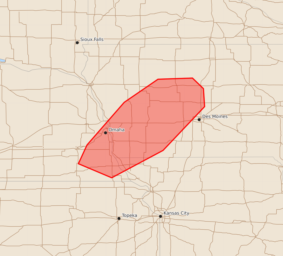
Summary
Isolated supercells may produce occasional large hail and damaging winds in far southeastern Nebraska and southwestern Iowa this evening.
Product Text
000 ACUS11 KWNS 282304 SWOMCD SPC MCD 282304 IAZ000-MOZ000-NEZ000-290100- Mesoscale Discussion 2416 NWS Storm Prediction Center Norman OK 0604 PM CDT Wed Oct 28 2026 Areas affected...far southeastern Nebraska into southwestern Iowa Concerning...Severe potential...Watch unlikely Valid 282304Z - 290100Z Probability of Watch Issuance...20 percent SUMMARY...Isolated supercells may produce a few instances of large hail and damaging wind this evening. DISCUSSION...Thunderstorm development has been ongoing near the eastward advancing cold front across portions of western Iowa into far southeastern Nebraska. The 18z RAOB from OAX shows a warm nose around 850 mb. More recent analysis from SPC Mesoanalysis continues to show MLCIN is present ahead of the front into portions of central Iowa. This mid-level warm layer/CIN and generally weak convergence/weak upper level forcing is likely what has made sustaining storms difficult. Nonetheless, a couple of cells have developed northeast of Omaha. The environment ahead of the front is characterized by moderate instability, steep low to mid-level lapse rates, and sufficient deep layer shear to support supercells. Should this cell or additional cells persist, they may pose some isolated potential for large hail and damaging wind. Overall, this threat appears to remain fairly isolated given the weaker forcing/MLCIN. ..Halbert-E/Guyer.. 10/28/2026 ...Please see www.spc.noaa.gov for graphic product... ATTN...WFO...DMX...EAX...OAX... LAT...LON 40939648 42029553 42619467 42649379 42379351 41919348 40799454 40099585 40459670 40459670 40939648 MOST PROBABLE PEAK WIND GUST...UP TO 60 MPH MOST PROBABLE PEAK HAIL SIZE...UP TO 1.25 IN