Mesoscale Discussion 2419
Issued as Mesoscale Discussion 2419 at · Valid:
Summary
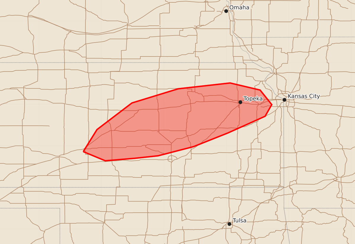
Isolated severe hail may occur across portions of central and northeastern Kansas this evening.
Product Text
000 ACUS11 KWNS 300026 SWOMCD SPC MCD 300026 KSZ000-300200- Mesoscale Discussion 2419 NWS Storm Prediction Center Norman OK 0726 PM CDT Thu Oct 29 2026 Areas affected...portions of central into northeastern Kansas Concerning...Severe potential...Watch unlikely Valid 300026Z - 300200Z Probability of Watch Issuance...20 percent SUMMARY...A few instances of severe hail may accompany the stronger storms this evening. DISCUSSION...Thunderstorms have been intensifying within the axis of a strengthening low-level jet, where appreciable 925-850 mb WAA was also noted per 00Z mesoanalysis. Ahead of the strengthening cells, the TOP 00Z observed sounding depicted an appreciably enlarged/curved and elongated hodograph just south of a baroclinic boundary. 7 C/km mid-level lapse rates atop an adequately moist boundary layer are also contributing to over 2000 J/kg MUCAPE. Other than some ascent associated with the low-level WAA advection, overall forcing is weak. Still, given that MLCINH is not overly strong south of the baroclinic boundary, any storms that manage to intensify and sustain themselves may become supercellular, accompanied by mainly a severe hail threat (given anticipated boundary layer decoupling in the next few hours). At the moment, the severe threat is expected to remain on the isolated side given overall weak forcing for ascent. ..Squitieri/Guyer.. 10/30/2026 ...Please see www.spc.noaa.gov for graphic product... ATTN...WFO...EAX...TOP...ICT...DDC... LAT...LON 37869944 38399911 39039827 39379716 39519591 39349519 38999491 38719507 38319596 37989679 37769764 37709820 37649891 37869944 MOST PROBABLE PEAK HAIL SIZE...1.00-1.75 IN