Mesoscale Discussion 2421
Issued as Mesoscale Discussion 2421 at · Valid:
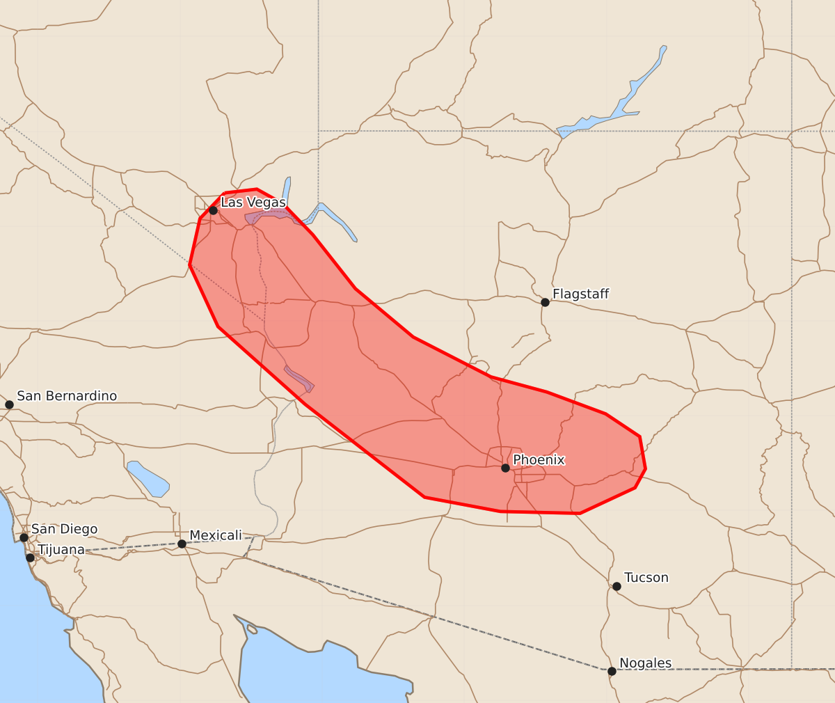
Summary
Isolated marginally severe hail, strong wind gusts, and possible landspouts may occur across portions of southern Nevada and western or central Arizona this afternoon and evening. These weather phenomena are expected to be limited in magnitude and spatially isolated.
Product Text
000 ACUS11 KWNS 302057 SWOMCD SPC MCD 302056 AZZ000-NVZ000-CAZ000-302300- Mesoscale Discussion 2421 NWS Storm Prediction Center Norman OK 0356 PM CDT Fri Oct 30 2026 Areas affected...portions of southern Nevada into western/central Arizona Concerning...Severe potential...Watch unlikely Valid 302056Z - 302300Z Probability of Watch Issuance...5 percent SUMMARY...An isolated risk for marginally severe hail, strong to locally severe wind gusts, and perhaps a landspout may accompany the strongest storms this afternoon/evening. Watch issuance is not expected. DISCUSSION...Convective coverage has gradually increased through 21 UTC ahead of an approaching mid-level shortwave trough evident over southern California in recent water vapor satellite imagery. While widespread cloud cover has been prevalent across the region through much of the day, filtered diurnal heating and dewpoints ranging from the mid-50s to low-60s F are supporting weak to moderate buoyancy of 500-1000+ J/kg MLCAPE, which has been sufficient for the development of a few relatively small and transiently stronger convective cores through mid-afternoon. Stronger mid/upper flow along the eastern periphery of the aforementioned shortwave trough (~40 kts at 8-9 km MSL per the FSX/IWA VWPs) and modest mid-level lapse rates around 7 C/km may support modestly greater organization of developing updrafts and isolated marginally severe hail through mid afternoon. Isolated strong to locally severe wind gusts may also occur, primarily where stronger heating has steepened low-level lapse rates. Lastly, some potential for a brief landspout may exist given pockets of stronger low-level buoyancy overlapping ambient surface vorticity, particularly in the NV/AZ border vicinity where latest objective analysis depicts NSTP values of 1-2. Given the overall expectations for any severe risk to remain limited in magnitude and spatially isolated, watch issuance is not expected. ..Chalmers/Smith.. 10/30/2026 ...Please see www.spc.noaa.gov for graphic product... ATTN...WFO...TWC...FGZ...PSR...VEF... LAT...LON 36351503 36391469 36241442 35911410 35341365 34831304 34411222 34251163 34021101 33781065 33441059 33241070 32971128 32991212 33141292 34121418 34941510 35591540 36081529 36351503 MOST PROBABLE PEAK TORNADO INTENSITY...UP TO 90 MPH MOST PROBABLE PEAK WIND GUST...UP TO 60 MPH MOST PROBABLE PEAK HAIL SIZE...UP TO 1.25 IN