Mesoscale Discussion 2431
Issued as Mesoscale Discussion 2431 at · Valid:
Summary
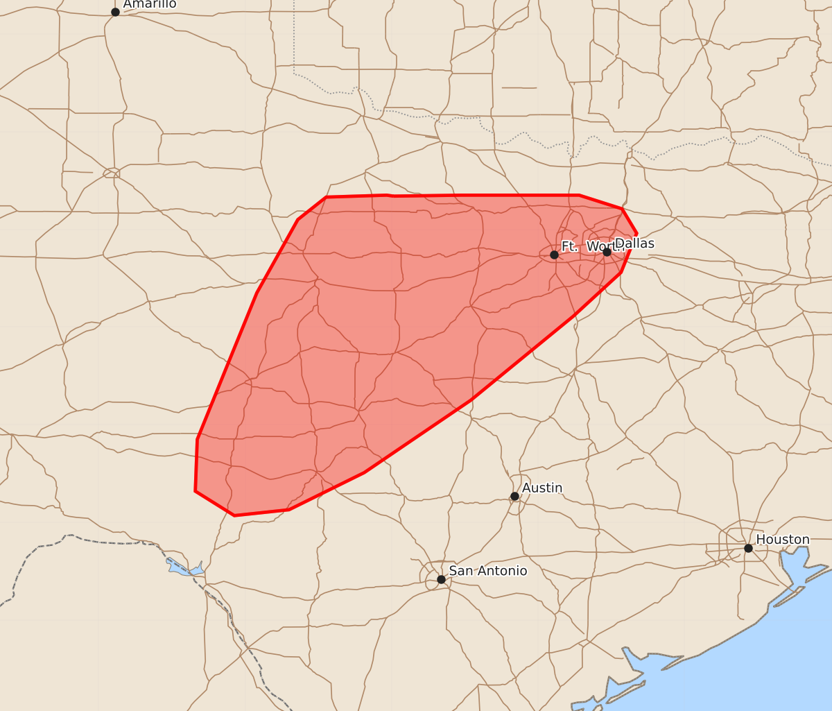
Severe thunderstorms capable of producing large hail, damaging winds, and tornadoes are expected to develop across northwest, central, and north Texas this afternoon and into the evening.
Product Text
000 ACUS11 KWNS 021955 SWOMCD SPC MCD 021955 TXZ000-022200- Mesoscale Discussion 2431 NWS Storm Prediction Center Norman OK 0155 PM CST Mon Nov 02 2026 Areas affected...portions of northwest...central...and north Texas Concerning...Severe potential...Watch possible Valid 021955Z - 022200Z Probability of Watch Issuance...60 percent SUMMARY...Thunderstorms are forecast to initiate along a dryline across northwest Texas this afternoon, with coverage gradually increasing with time. Initial supercells will quickly transition toward a mixed-mode of supercells and linear segments, with a threat for all severe hazards. DISCUSSION...Latest visible satellite imagery depicts developing cumulus along/ahead of a surface dryline across portions of West Texas and the Texas Panhandle. Downstream observations across northwest Texas depict temperatures warming to near 80 F behind a clearing stratus layer and amidst 100-mb mean mixing ratios of 14-15 g/kg, with this combination supporting 1000-1500 J/kg MLCAPE. Continued heating through mid/late afternoon combined with increasing large-scale ascent ahead of an approaching mid-level shortwave trough currently noted over the eastern CO/NM border will continue to foster additional destabilization through this evening. As this shortwave transitions eastward, an attendant 60-70-kt mid-level jet streak will begin to overlap northwest/north Texas, with 40-50+ kts of effective shear supporting initial supercells capable of primarily large hail. With time, increasing storm coverage, particularly across northwest/north Texas, will favor a transition to a mixed-mode of supercells/linear segments and an associated increase in the threat for damaging/severe winds. A few tornadoes also appear possible owing to a strengthening low-level jet and increasingly clockwise-curved, low-level hodographs; although, some uncertainty surrounding this threat exists as the axis of strongest 850-mb flow will be displaced farther northeastward. Regardless, watch issuance may be needed for at least a portion of the Slight-risk area to cover these threats. Farther south into central Texas, storm coverage is forecast to increase later this evening as the low-level jet strengthens; however, deep-layer flow/shear and related large-scale forcing weaken with southward extent. This suggests that the severe risk is likely to remain more isolated farther southward. ..Chalmers/Bentley.. 11/02/2026 ...Please see www.spc.noaa.gov for graphic product... ATTN...WFO...FWD...EWX...SJT...LUB... LAT...LON 33349898 33359828 33359757 33359708 33219664 32969649 32569665 32119714 31259819 30519928 30130005 30070061 30320101 30850099 31540071 32350038 33109996 33339967 33359905 33349898 MOST PROBABLE PEAK TORNADO INTENSITY...100-125 MPH MOST PROBABLE PEAK WIND GUST...65-80 MPH MOST PROBABLE PEAK HAIL SIZE...1.00-1.75 IN