Mesoscale Discussion 2439
Issued as Mesoscale Discussion 2439 at · Valid:
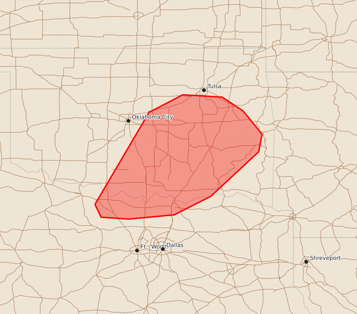
Summary
Tornadoes and severe thunderstorm lines are possible across portions of central and eastern Oklahoma into north Texas through the overnight hours. These storms may produce wind gusts up to 60 mph and tornado intensities between 85 and 110 mph.
Product Text
000 ACUS11 KWNS 030321 SWOMCD SPC MCD 030320 OKZ000-TXZ000-030445- Mesoscale Discussion 2439 NWS Storm Prediction Center Norman OK 0920 PM CST Mon Nov 02 2026 Areas affected...Portions of central/eastern Oklahoma into far North Texas Concerning...Tornado Watch 701...702...703... Valid 030320Z - 030445Z The severe weather threat for Tornado Watch 701, 702, 703 continues. SUMMARY...A strong low-level jet will continue to support the risk for QLCS circulations from the Red River vicinity into east-central Oklahoma. DISCUSSION...Several linear segments continue slowly eastward across Oklahoma into North Texas. The strongest convection exists near the Red River. While a local dry pocket of surface air exists ahead of the current activity, upper 60s F dewpoints continue to stream through the ArkLaTex into eastern Oklahoma. A strong low-level jet is evident in KINX VAD data (50-55 kt in the lowest km). A few showers have started to develop near the AR/OK border in association with the low-level warm advection. Given the strength of the low-level shear, QLCS circulations will remain possible into the overnight. Depending on how convection along the Red River evolves, local extensions in time/area of WW 702 may be needed if intensity is maintained. ..Wendt.. 11/03/2026 ...Please see www.spc.noaa.gov for graphic product... ATTN...WFO...TSA...FWD...OUN... LAT...LON 33719822 35659708 36029637 35979554 35689510 35199470 34829477 33889578 33499655 33409751 33449809 33719822 MOST PROBABLE PEAK TORNADO INTENSITY...85-110 MPH MOST PROBABLE PEAK WIND GUST...UP TO 60 MPH